8:00 - 20:00
Mon - Sun
Every SeaColors expedition feeds a growing body of scientific knowledge. Explore the tools we use to collect, manage and share our long-term research on whales, dolphins and the wider Azorean marine ecosystem.
For many years, Sea Colors Expeditions has been establishing a robust scientific foundation for the study of marine species in the Azores region. Through the systematic and long-term collection of biological, ecological, and behavioral data, the organization makes a significant contribution to the understanding of complex marine ecosystems and the species that inhabit them.
Long-term datasets are particularly valuable, as they allow researchers to distinguish natural variability from long-term ecological change, thereby enabling scientifically sound interpretations of population dynamics, behavioral adaptations, and environmental influences.

Geographic location, seasonal timing, movement patterns and migratory pathways.
Social structures, interspecific interactions and biometric parameters of individual animals.
Body condition, visible injuries, stress indicators and overall physical status.
Foraging strategies, prey preferences and feeding behaviour — key to understanding the food web.


The continuous acquisition of scientific data enables a comprehensive characterization of marine fauna and their behavior under varying environmental conditions. In practice, that means four core areas of data collection:
The subsequent analysis and evaluation of these datasets serve to test hypotheses, identify emerging patterns, and reveal trends that may indicate environmental change or anthropogenic influence. In a rapidly changing ocean, affected by climate change, increasing maritime traffic, and other human-induced pressures, such data-driven approaches are indispensable.
Only through reliable, long-term scientific evidence can the impacts of human activities on marine species be objectively assessed and effective conservation and management strategies be developed. Beyond their scientific value, these data play a crucial role in fostering a deeper awareness of marine life and its ecological importance.
In conclusion, the systematic collection and rigorous analysis of long-term scientific data are essential for advancing our understanding of marine organisms, safeguarding their habitats, and encouraging a respectful and sustainable coexistence between humans and the marine environment.
 Research Project
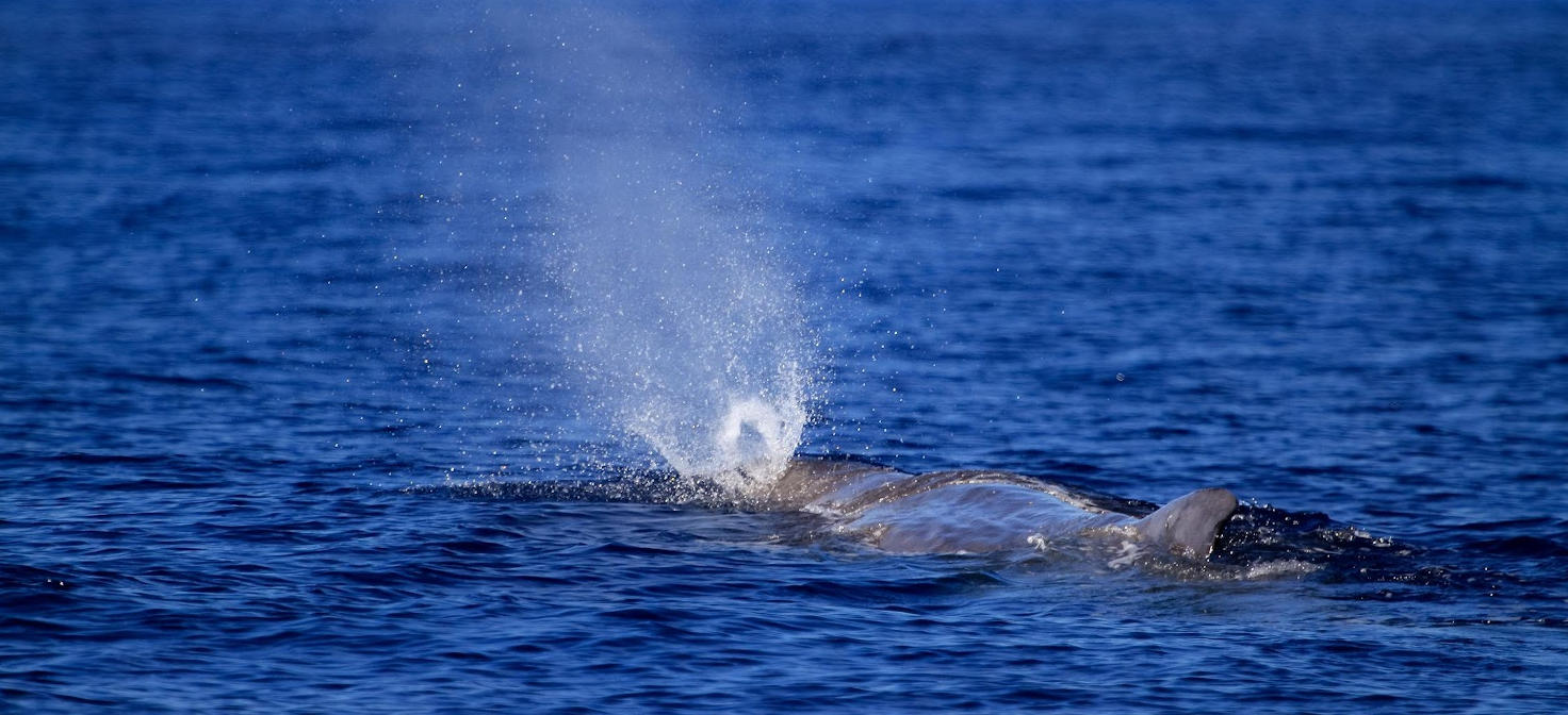
One of the primary objectives of the Sperm Whale Project is to enhance knowledge of sperm whale social groups in the waters surrounding São Miguel, thereby providing a robust scientific basis for their conservation.
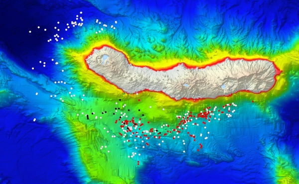
The project aims to document the distribution and abundance of sperm whales around São Miguel Island and to expand and refine the photo-identification (Photo-ID) catalogue for the Azores. This catalogue will be systematically compared with Photo-ID catalogues from other islands, with a particular focus on the Macaronesia region, in order to improve understanding of large-scale distribution patterns and to identify key habitats and areas of ecological importance for sperm whales observed around the island.
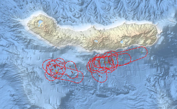
Further objectives include estimating the spatial range and area use of encountered sperm whale social units, as well as documenting habitat use, activity patterns, and spatial distribution, with special emphasis on surface behaviour. Behavioural observations will be correlated with simultaneously recorded acoustic data to relate activity and behaviour to sound production.
The project also seeks to collect detailed information on the natural behaviour of sperm whales at both individual and group levels, including feeding strategies and prey composition. Morphometric data will be analysed in relation to age class and sex, and body condition assessments will be conducted to evaluate overall health status.
Additional goals include determining group size, group composition, and clan structure of sperm whale units present in the study area, as well as estimating re-sighting rates. The effects of human disturbance will be assessed by examining changes in sperm whale activity and behaviour in the presence of research vessels and drones, taking into account variables such as distance, movement patterns, altitude, speed, and angle of approach.
Finally, the project aims to contribute to a broader understanding of whale behaviour and population dynamics in the region.
 Satellite Monitoring
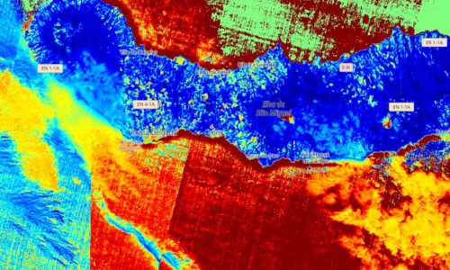
The primary objective of this satellite-based research project is the development of a robust and scalable algorithm for the automated detection of whales in the waters surrounding the Azores, including geographically remote and difficult-to-access regions. The approach is based on the analysis of high-resolution satellite imagery and aims to significantly enhance large-scale marine mammal monitoring capabilities.
Beyond mere detection, the project integrates whale occurrence data with additional environmental and atmospheric information derived from the Copernicus Sentinel satellite missions. These complementary datasets include, among others, sea surface temperature, air quality parameters, ozone concentration, solar radiation, and broader climate indicators. By combining biological observations with physical and atmospheric variables, the project seeks to establish a comprehensive framework for analyzing whale distribution and behavior in relation to environmental dynamics.
High-resolution satellite imagery represents a promising solution for monitoring whale populations over large spatial scales. However, this approach generates vast amounts of data, rendering manual image inspection infeasible. To address this challenge, advanced machine learning techniques are employed to automate the detection process. These algorithms are designed to identify image segments with a high probability of containing whales, thereby enabling efficient and objective large-scale analyses.
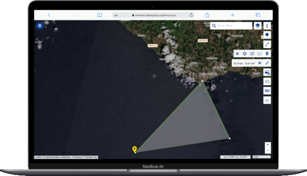
Within the Seacolors framework, multiple machine learning models have been evaluated for their suitability in detecting cetaceans in satellite imagery. Initial experiments indicate that traditional regression-based approaches, such as Ridge Regression, are not well suited to this classification task. In contrast, classification-oriented methods demonstrate substantially better performance.
In particular, Support Vector Classifiers (SVC) and Convolutional Neural Networks (CNN) have proven to be the most effective models for whale detection. While SVCs offer robust classification capabilities for well-structured feature spaces, CNNs are especially powerful due to their ability to automatically learn complex spatial patterns directly from image data. These models form the methodological core of the project's detection pipeline.
Based on the results obtained in the Azores region, the developed model will be progressively expanded to cover the wider North Atlantic. In the long term, the methodology is intended to be transferable to a global scale. This will enable comprehensive analyses of marine mammal behavior under the influence of climate change and increasing human activities, such as shipping, fishing, and offshore development.
By providing a scalable, satellite-based monitoring tool, the project contributes to both marine conservation efforts and the broader scientific understanding of how environmental change impacts marine ecosystems.
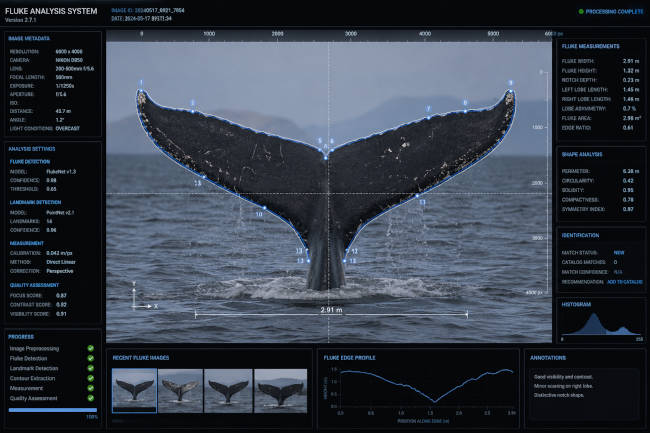
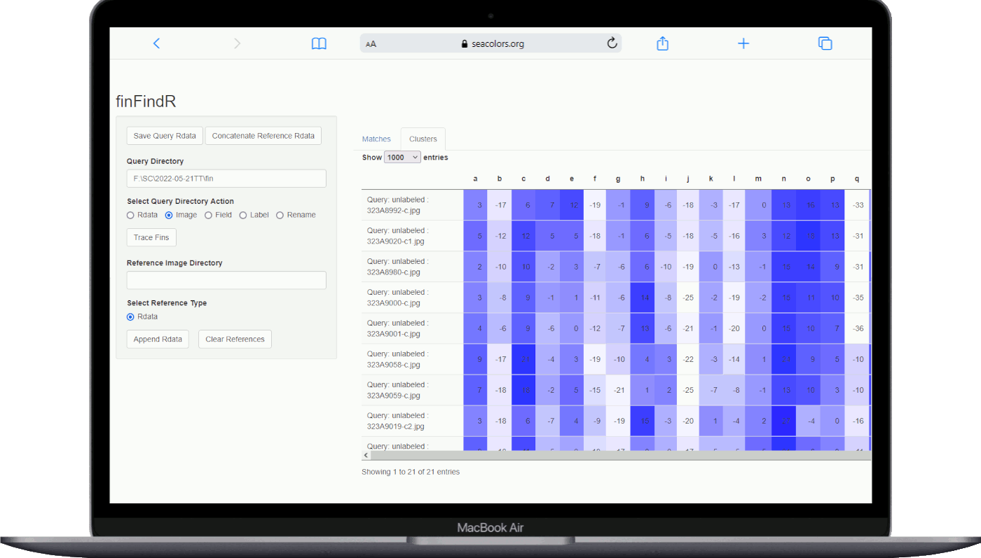
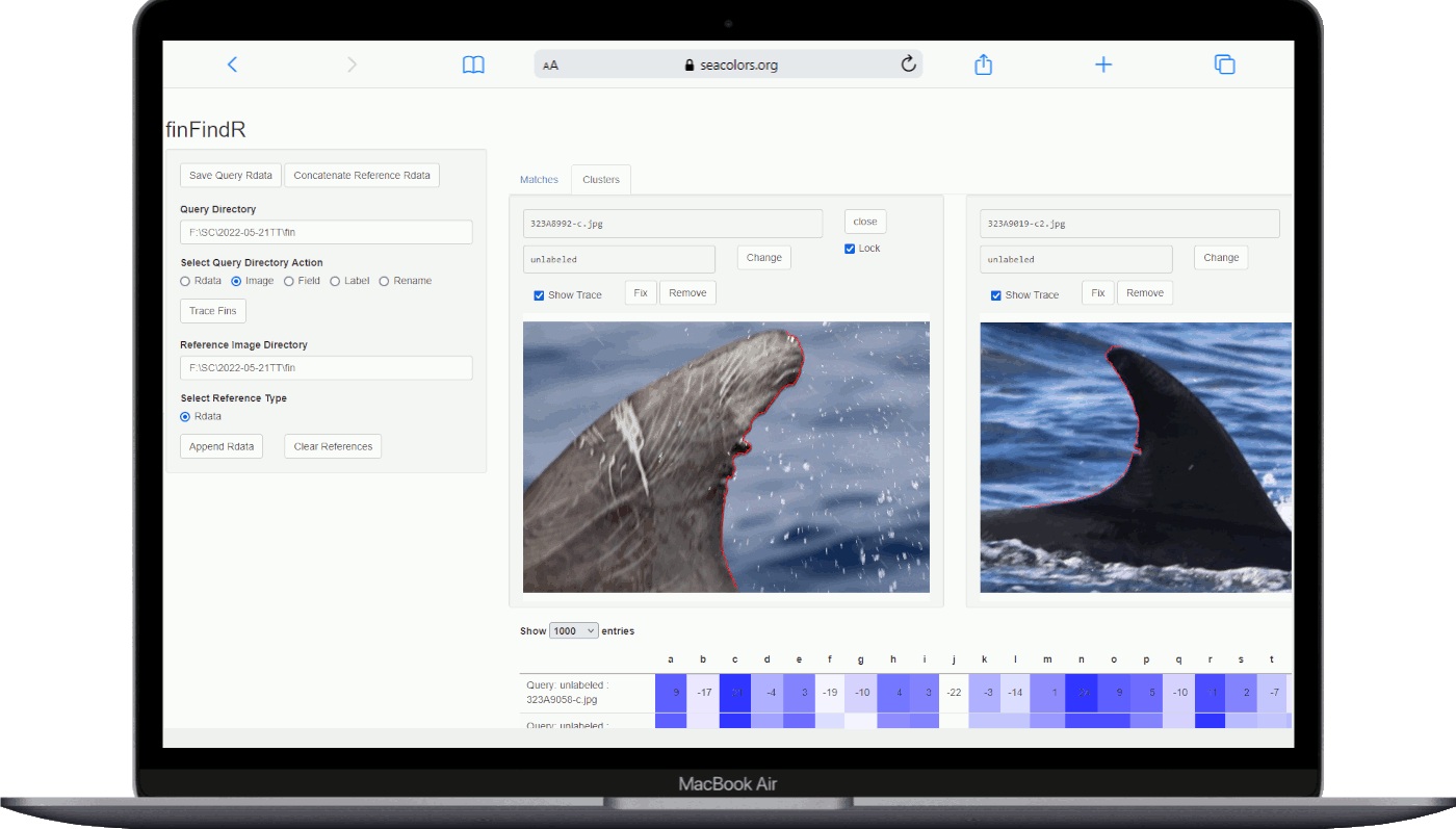
Sea Colors Expeditions has developed an artificial intelligence–based framework for the automated photo-identification of cetaceans. The system integrates computer vision and machine-learning algorithms to analyse high-resolution photographic data of key morphological features, including flukes, dorsal fins, pigmentation patterns, and naturally occurring scars. These features are extracted and quantified to generate individual-specific visual signatures, enabling robust discrimination between conspecific individuals.
As part of long-term, systematic field research, an extensive and continuously expanding photo-identification database has been established and curated. This database provides the empirical foundation for training, validating, and refining the AI models, and supports longitudinal tracking of individual cetaceans as well as population-level monitoring across temporal and spatial scales.
The AI-assisted identification framework substantially increases the efficiency and scalability of photo-identification workflows by automating the matching of new photographic records against existing catalogues through pattern-recognition techniques. This approach significantly reduces manual processing time and observer bias, while preserving the non-invasive nature of photo-identification as a standard method in cetacean research and conservation.
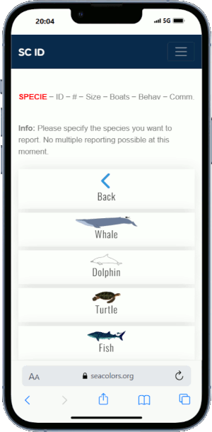
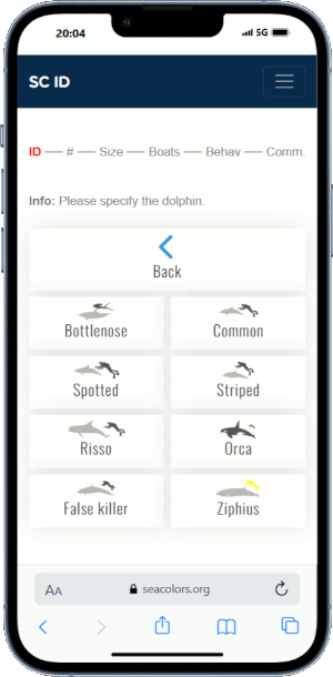
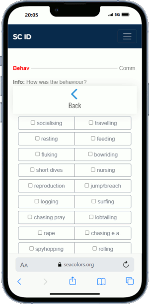
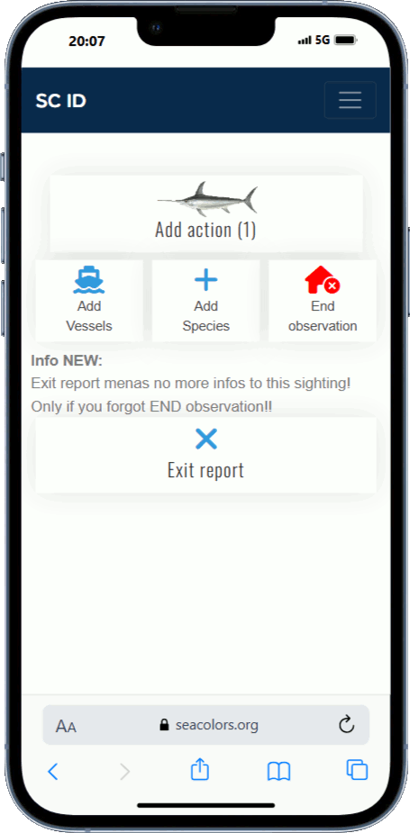
From the very first research trip, data collection was conducted using standardized paper datasheets and well-trained captains, who systematically recorded all daily sightings as well as the observed behaviour. These records were carefully compiled throughout the field season, and at the end of each season all data were manually transferred into a central database, sheet by sheet and trip by trip. Although this approach ensured a high level of data reliability, it was time-consuming and limited the immediate availability of the collected information.
With ongoing technological advancements and the increasing demand for real-time data in our research activities, the requirements for data acquisition have evolved significantly. To address these challenges, we have replaced traditional paper datasheets with a custom-developed digital application. This application enables the standardized and comprehensive recording of sightings, thereby minimizing the risk of missing relevant information and ensuring greater consistency across observers. In addition, the new system allows for the integration of supplementary environmental data, such as weather conditions and sea state, which are automatically retrieved via web services. As a result, the overall data quality, efficiency of collection, and timeliness of availability have been substantially improved, supporting more robust and responsive scientific analyses.
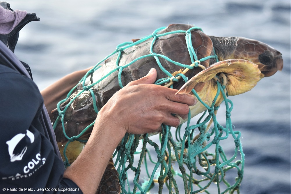 Conservation
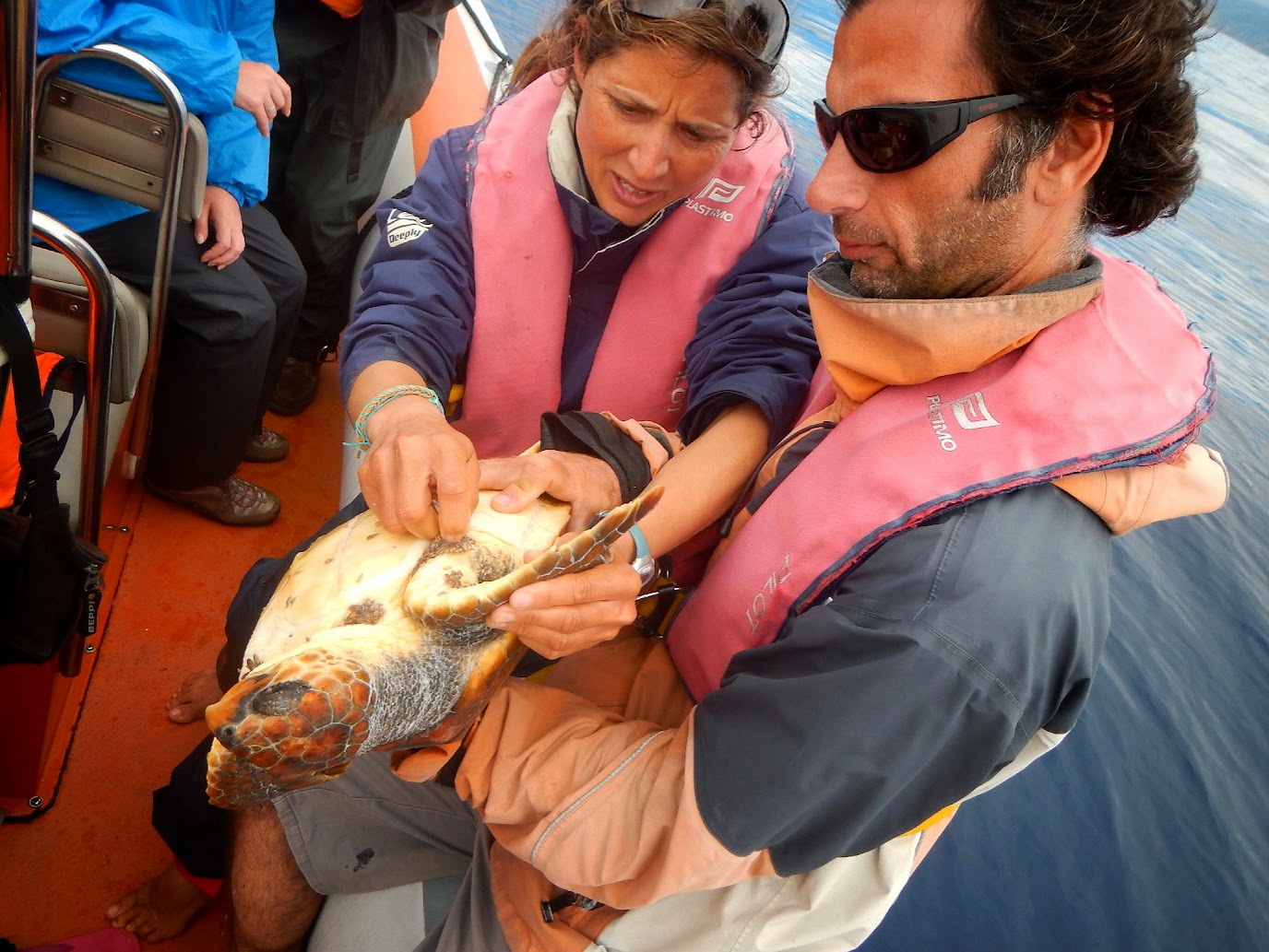
If we aim to preserve and protect the marine wildlife we need to persist in the enduring hunt for knowledge. At the present a lot of the cetacean species lack an evaluation of status on IUCNs red list due to data deficiency.
For those cetaceans that are evaluated to be endangered (and there are quite a few) holistic information is required in order to set up a successful conservation strategy. Also we might not just want to save what is endangered or concentrate on a specie level, but rather manage the marine resources on the appropriate scale, big and small.
Increasing this knowledge we are able to suggest measures that are relevant and applicable in insuring the welfare of the animals while also serving to increase quality in respect to the marine wildlife tourism activity (encompassing regulations, vessel conduct, procedures as well as management strategy).
This project aims to better understand cetacean distribution and habitat use in our waters, in response to the pressing need for baseline information on cetaceans in this data-poor area. This Passive Acoustic Monitoring project aims to fill important knowledge gaps and specifically investigate the temporal and spatial distribution of vocalizing cetaceans and also an opportunity to characterize temporal and spatial variability in noise levels around Whale Watching vessels activity.
Sperm whales are one of the loudest animals in the ocean and on Earth, producing sounds up to 230 decibels. This is louder than jet engines, which are about 150 decibels.
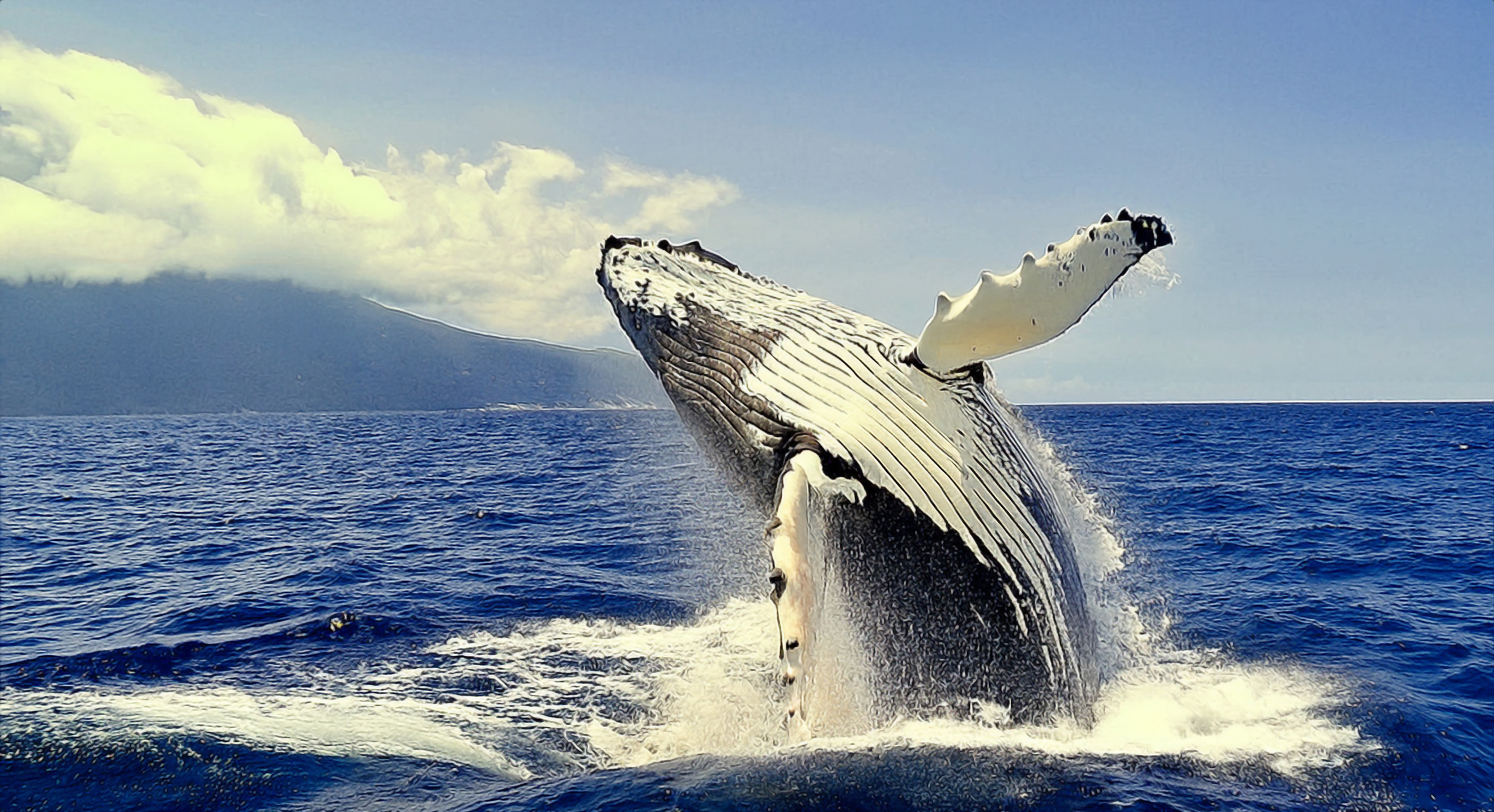 Field Data
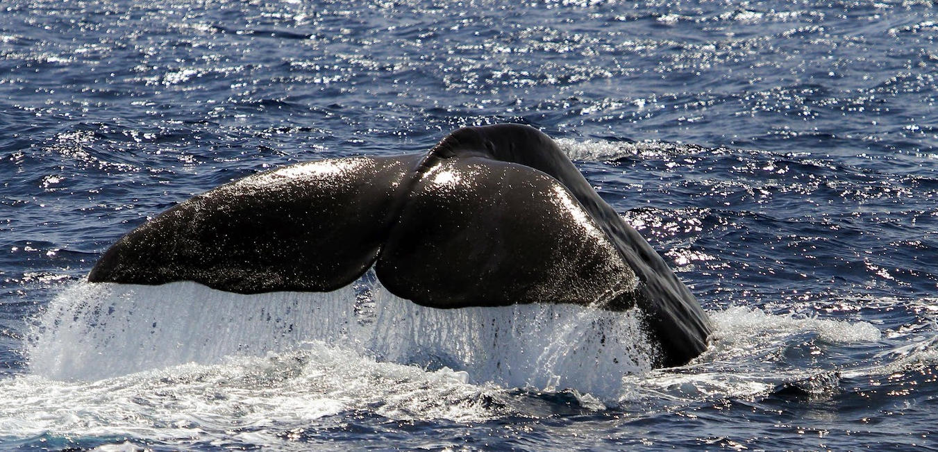
We observe and register the behavior of individuals and groups of cetaceans and other sea animals, documenting field data, taking notes or using voice recorders, GPS and video footage. Information about, number individual whales present, geographic position, date, time, etc is taken by our developed app - App on Sea.
How data is used
Data collected on whales and dolphins can be used to develop conservation policies and initiatives.

The documentation of the distribution of the cetaceans we observe every year, and its comparison, is important to understand habitat use in and relate to oceanographic variables.
We have developed a special mobile APP to register these sightings in a standardized way. You can find more information about this project in our "project section".
Beside the scientific need of these data, we can also provide the probability to see a specific cetacean in a specific month during a trip with Sea Colors.
Choose the month you want to know and see how big is the chance to see your favourite cetacean. Maybe a good option to plan an expedition with us. To keep it well-aranged, we show up the top 5 cetaceans, based on the trips from the last years, and we did a lot of trips...